.png)
Welcome,
Date:2023-11-09
keyword:
Recently, affected by typhoon Du Surui, many parts of China have suffered continuous heavy rainfall, which caused urban waterlogging, debris slides, landslides, mountain floods, and other secondary disasters in some areas. In fact, in many parts of China, affected by extreme weather conditions, ecological damage, and other factors- debris flow, landslides, and other geological disasters occasionally occur. This kind of geological disaster suddenly broke down, damaging houses and other engineering facilities, and destroying trees and farmland and causing numerous casualties.
Effective monitoring and prevention technology could warn before the occurrence of the geological disaster, and help the relevant departments to make decisions in advance, timely evacuate, and protect the safety of the people. The traditional dynamic monitoring of regional geological disasters mainly obtains the status information of geological disasters utilizing group surveys and prevention and evaluates the stability of geological disasters by empirical analysis. This method requires high technical requirements for monitoring personnel and a lot of workforces, materials, and financial resources. Secondly, manual monitoring efficiency is low, and it is complex to realize the continuous real-time monitoring and timely prediction of disaster areas.
eSurvey GNSS, based on Beidou / GNSS high precision positioning technology, combined diversified sensor technology and cloud platform + cloud computing technology, and launched a series of reconnaissance designs to equipment installation, to the system platform and data universal disaster monitoring solutions. The application takes measures according to local weather conditions and accurately precise supporting products and services. It can carry out all-weather and automatic monitoring of geological disasters, obtain displacement, tilt, collapse, settlement, and other changes, and the accuracy can reach a millimeter level.
Through data analysis and early
warning mechanisms, to advance and early warning, effectively reduce or prevent
the occurrence of safety accidents, realize the geological disaster prevention
and control of scientific management, informatization, standardization, and
visualization, provide a scientific basis for disaster prevention and
mitigation decisions, for relevant departments to provide a set of reliable,
practical, professional geological disaster prediction and early warning system
solutions.
The application of
the disaster deformation monitoring solution in Heyuan, Guangdong province
Heyuan City is located in
the northeast of Guangdong Province, the middle and upper reaches of the
Dongjiang River, only 100 kilometers away from 
Guangzhou, Shenzhen, Hong Kong, and other big cities. It is the source of drinking water in the downstream areas and is known as the "green pearl" along the Dongjiang River. The terrain of the river source is mainly mountainous and hilly, and the regional geological disasters served are collapse and landslide. The main objects of prevention and control are mountainous schools, towns, villages, hospitals, markets, forestry operation areas and other people gathering places, cutting slopes, residential areas of people along the railway, highway, and other traffic trunk lines and surrounding areas. According to the local meteorological and hydrological characteristics, June to August (the flood season) is the most crucial prevention period for sudden geological disasters. During this period, the monitoring of debris flow, landslides, collapse, and other geological disasters caused by rainfall.
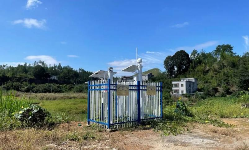
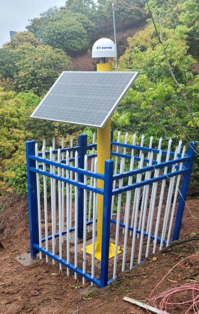
In this project, our team installed the platform bound more than 600 equipment units to provide real-time processing of monitoring data and early warning technical support services. A large number and wide distribution of hidden danger points in the project monitoring area, distributed in multiple counties and districts, The Disaster monitoring site has a complex terrain environment, many types of monitoring equipment (GNSS receiver, crack gauge, inclination accelerometer, rain gauge, alarm, soil moisture content gauge, mud position gauge). Our staff maintains a consistent, rigorous, and responsible work style, listens patiently to the needs of the project site, and provides multiple-to-one in-depth service support. Throughout the project, there was successfully completed installation and debugging of more than 600 sets of disaster monitoring equipment. In addition, the data access of the system platform and the early warning model configuration are integrated. In this project, the organization and technical ability of eSurvey GNSS to deal with the complex deformation monitoring project are highly recognized by the project side.
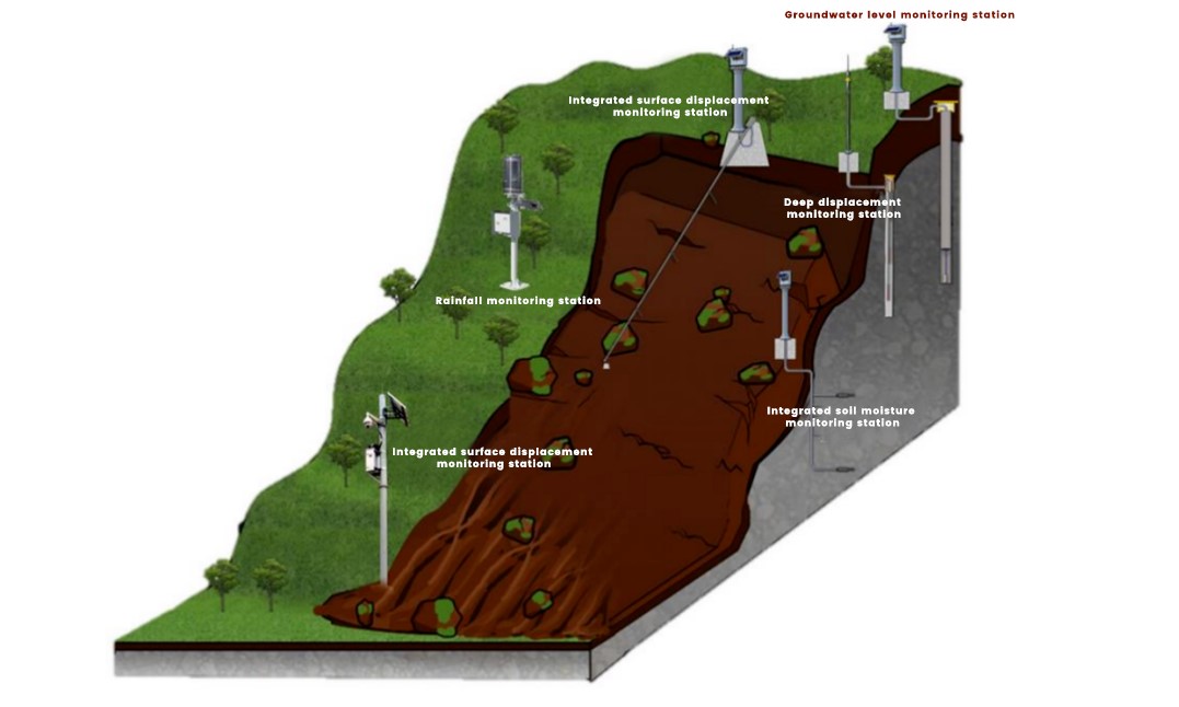
Solution composition
Build a monitoring network system according to
local conditions
After the monitoring equipment monitors the abnormal data, the platform will automatically send the alarm instruction to the alarm, drive the on-site sound and optical alarm or household alarm, and promptly notify the residents on the scene, so as to avoid the loss of life and property of the people. Field video surveillance is one of the geological disaster monitoring means gradually adopted with the development of wireless network technology, which plays a crucial role in the remote monitoring of geological disaster sites. The management department conducts a remote assessment of the disaster situation and designs targeted emergency plans using the video surveillance system.
The main equipment of the application
MIS 20
choke-integrated monitoring GNSS receiver
Integration intelligent GNSS monitoring receiver is the first choice for disaster monitoring equipment. MIS 20 is a monitoring GNSS receiver that offers high stability and high reliability, is easy to use, cost-efficient, and can be applied to various types of surface displacement deformation monitoring under harsh environments. Its integrated structural design and function in the monitoring field can meet high-precision surface displacement monitoring applications.
The integrated choke antenna used by the MIS 20 ensures better tracking of the satellite signals and the stability and accuracy of the phase centers in various environments. MIS 20 has excellent industrial protection level and millimeter-level accuracy and ensures continuous and synchronous monitoring of each monitoring point under extreme weather conditions such as rainstorms. Meanwhile, the built-in MEMS sensor supports the encryption report immediately after the equipment attitude changes.
Pour Angle
acceleration sensor
The inclination accelerometer is a three-axis intelligent inclination vibration sensor, which innovatively integrates power supply and transmission. It is used for all-directional inclination and vibration (frequency and amplitude) measurements in three-dimensional space. It is excellent for the posture and early warning of landslides collapses, slopes, dangerous rocks, houses, and bridges.
Integrated
crack meter
eSurvey GNSS’s integration fracture meter integrated high precision linear displacement sensor, integrated three-axis high precision inclination and MEMS acceleration monitor, and built-in integration of power supply and transmission unit, can real-time monitoring of deformation surface crack development, and real-time monitoring of three XYZ acceleration and Angle change, is widely used in monitoring landslide, collapse, slope, dangerous rock, bridge, building health hazards crack development and attitude change and early warning.
Piezoelectric
rain gauge
eSurvey GNSS's pressure electric type rainfall gauge based on the principle of piezoelectric effect research and development of rainfall monitoring products, built-in integration of power supply and transmission, compared with the traditional bucket type rain gauge, no complex mechanical structure and additional data upload unit, with simple structure, strong integration, convenient installation, free maintenance, low cost, widely suitable for geological disasters, environmental monitoring, water conservancy and hydropower and other application fields.
Soil moisture
content meter
eSurvey GNSS’s integration tube multilayer soil moisture content meter is based on the dielectric constant principle of sensor, built-in integration of power supply and transmission, for different levels of soil moisture content and temperature state for dynamic observation, the highest can detect eight layers of soil temperature and humidity, can quickly, comprehensive understanding of soil moisture information, at the same time the built-in MEMS sensor, can slip the landslide attitude change warning, more scientific disaster reduction plan, minimize disaster loss.
Ducking meter
The mud water level meter is based on accurate time measurement of electromagnetic wave ranging technology, sensor emission electromagnetic irradiation surface. It receives the echo, thus obtaining the distance of the surface to the electromagnetic wave emission point, distance change rate (radial velocity), orientation, height and other information of a high precision, non-contact mud level measurement products, in disaster monitoring is suitable for monitoring gully debris flow.
Acoustic and
light alarm device
The sound and light alarm is suitable for receiving disaster warning information. The warning information automatically appears through the platform, and the danger information is transmitted to the monitoring site the first time, providing valuable time for people to evacuate.
Technical
highlights of the application
1. MIS 20
monitoring receiver supporting Beidou / GNSS, with excellent industrial
protection level and extremely high accuracy, to ensure that the overall error
of continuous and synchronous monitoring of each monitoring point under extreme
weather conditions such as rainstorms is not more than 3mm;
2. The
multi-system GNSS high-precision solution engine based on Beidou / GNSS
realizes the high-precision and automated GNSS baseline solution, and the
solution accuracy is better than 3mm;
3. Based on the
realization of the front-end solution function of Wi-Fi AD hoc network, it
effectively reduces the dependence on the public network bandwidth, improves
the availability of areas with poor network signal coverage, and reduces the
operation and maintenance cost in the later period;
4. Multi-sensor fusion processing provides efficient data support for prediction.
In addition to Heyuan in Guangdong province, at present, the universal disaster deformation monitoring solution has been applied to serve the frequent geological disaster areas in Guangdong, Guangxi, Hunan, Hubei, and other places, realizing the 24-hour real-time monitoring and early warning of hidden geological disasters, and silently contributing to protect the safety of the side of the party.

 eRTK10 mini
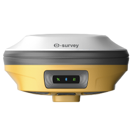 eRTK20
 eRTK25
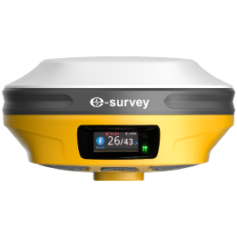 eRTK30
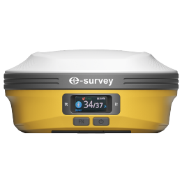 eRTK60
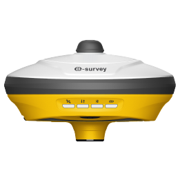 eBase 20
.png) eBase 30
eBase 30 E300 Pro
 E500
E500 E800
E800 E800 Pro
 E600
E600 eDMR1
eDMR1 eSAR50
 NET10
NET10 NET20 PLUS
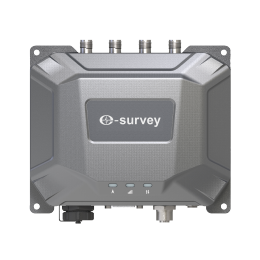 eHP10
eHP10 eHP10 Lite
 P8III
P8III P9IV
P9IV P9V
P9V UT32
UT32 eSA3
eSA3 260_260.png) eT80(H)
eT80(H) Surpad4.2
 GEOSolution
 RootNet
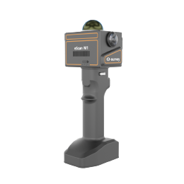 eScan M1
 eHLS2
eHLS2 eLidar A1
 eME10
eME10 eME30
eME30 eMP10
eMP10 eMG30
eMG30 eMR10
eMR10 eMB10
eMB10 eMC10
eMC10 EAS502
 Bestar 301
  EAS301 Pro Motor
 EAS301 Pro Hydraulic
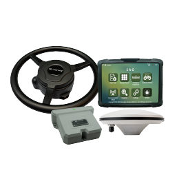 EAS100
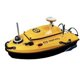 VE115
VE115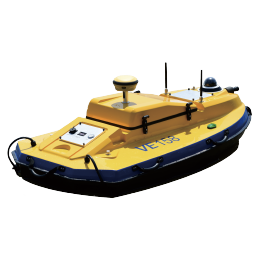 VE158
VE158 VE90
VE90.png) eTS32
eTS32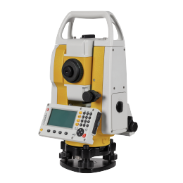 E3
E3 eTS2
eTS2 eTS8
eTS8 ESL2
ESL2 ESL3
ESL3 ET2A
ET2A TRU35
TRU35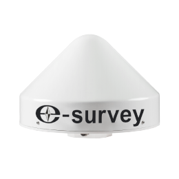 UA91
UA91 UA92
UA92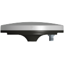 UA35
UA35.png)

